The Silvretta Alps are a mountain range of the Central Eastern Alps shared by Tirol, Vorarlberg (both in Austria) and Graubünden (Switzerland). The Austrian states of Tirol and Vorarlberg are connected by a pass road (Silvretta Hochalpenstraße at 2032 m). The majority of the peaks are elevated above three thousand metres and are surrounded by glaciers. Thus, the area is also known as the "Blue Silvretta".BordersAccording to the Alpine Clubs, the Silvretta Alps are outlined from other groups by the following borders: St. Gallenkirch - Ill river as far as Partenen - Zeinisjoch - Zeinisbach - Paznauntal as far as Ischgl - Fimbertal - Fimber Pass - Val Chöglias - Val Sinestra - Inn River from the mouth of the Branclabach to the mouth of the Susasca - Val Susasca - Flüela Pass - Davos - Wolfgang - Laretbach - Klosters - Schlappinbach - Schlappiner Joch - Valzifensbach - Gargellental - St. Gallenkirch
 Silvretta (jezioro)
1 km
Silvretta ist immer wieder ein Erlebnis. Von der spaßigen Passstraße über den netten ... Silvretta-Stausee
1 km
Silvretta ist immer wieder ein Erlebnis. Von der spaßigen Passstraße über den netten ... Wiegensee
6 km
Schon sehr schöner Weg....aber nachdem der Platz als Österreichs schönster Platz ausg...
Silvretta (jezioro)
1 km
Silvretta ist immer wieder ein Erlebnis. Von der spaßigen Passstraße über den netten ... Silvretta-Stausee
1 km
Silvretta ist immer wieder ein Erlebnis. Von der spaßigen Passstraße über den netten ... Wiegensee
6 km
Schon sehr schöner Weg....aber nachdem der Platz als Österreichs schönster Platz ausg...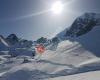 Silvretta
13 km
In einem guten Winter sicherlich ein tolles Skigebiet. Mir ist es allerdings schleier...
Silvretta
13 km
In einem guten Winter sicherlich ein tolles Skigebiet. Mir ist es allerdings schleier...hinzufügen eines Silvretta Alps-stadtplans zu ihrer webseite;

Wir verwenden Cookies und andere Tracking-Technologien, um Ihr Surferlebnis auf unserer Website zu verbessern, Ihnen personalisierte Inhalte und gezielte Anzeigen anzuzeigen, unseren Website-Verkehr zu analysieren und zu verstehen, woher unsere Besucher kommen. Datenschutz-Bestimmungen