The Dreiländerspitze is one of the higher mountains in the Silvretta range in the eastern Alps, at 3,197 metres. The borders of Graubünden (Switzerland), Vorarlberg (Austria) and Tyrol (Austria) meet at the peak. Its name (Dreiländerspitze means peak of three countries) refers to a meeting point between the territories of three ancient tribes (Rhaeto-Romance or Romansch, Bavarii and Alamanni) and their languages. It is also on the watershed between the Rhine and Danube. It is a favourite viewpoint, due to its position and accessibility. Its first documented ascent was by the German alpinist Theodor Petersen, accompanied by two locals, on 14 July 1870, although it appeared to have been previously climbed by surveyors in the 1850s. The nearest settlements are Galtür, 14 km to the north, and Guarda, 9 km to the south.
 Dreiländerspitze
0 meter
Toller Gipfel. An Tagen wo viel los ist, muss man seine gipfelbrotzeit gegebenfalls 2...
Dreiländerspitze
0 meter
Toller Gipfel. An Tagen wo viel los ist, muss man seine gipfelbrotzeit gegebenfalls 2... Vermunt Pass
2 km
Vermunt Pass är ett bergspass i Schweiz. Det ligger i den östra delen av landet, km ö...
Vermunt Pass
2 km
Vermunt Pass är ett bergspass i Schweiz. Det ligger i den östra delen av landet, km ö...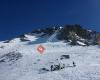 Piz Buin
2 km
Der Piz Buin, genauer: Großer Piz Buin, auf der Grenze zwischen Österreich und der Sc... Ochsentaler Gletscher
3 km
Piz buin und der Gletscher da sollte einfach jeder Mal wandern gewesen sein. Silvrettahorn
4 km
An Samstagen kann der Gipfel recht hoch frequentiert sein. Schöner Gipfel für Erfahre... Hohes Rad
5 km
Gigantischer Ausblick auf die Alpen und den Piz Buin!. Aufstieg ist gut machbar wenn ... Klostertal (Silvretta)
7 km
Das Klostertal ist ein kleines Gebirgstal in der Silvrettagruppe, südlich des Silvret...
Piz Buin
2 km
Der Piz Buin, genauer: Großer Piz Buin, auf der Grenze zwischen Österreich und der Sc... Ochsentaler Gletscher
3 km
Piz buin und der Gletscher da sollte einfach jeder Mal wandern gewesen sein. Silvrettahorn
4 km
An Samstagen kann der Gipfel recht hoch frequentiert sein. Schöner Gipfel für Erfahre... Hohes Rad
5 km
Gigantischer Ausblick auf die Alpen und den Piz Buin!. Aufstieg ist gut machbar wenn ... Klostertal (Silvretta)
7 km
Das Klostertal ist ein kleines Gebirgstal in der Silvrettagruppe, südlich des Silvret...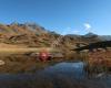 Neue Heilbronner Hütte
10 km
Ich war im Zuge auf einer Hüttentour auf der Neuen Heilbronner Hütte zu Besuch. Das P... Vermuntsee
12 km
Eine sehr schöne Gegend,genügend Parkplatz,zum wandern,oder mit dem E-Bike auf die Sa... Zeinisjoch
14 km
Toller Aufenthalt trotz schlechtem Wetter. Das Essen im Rahmen der Halbpension wie im... Vermuntbahn
14 km
Im Winter geht die Bergbahn, um Sommer leider nicht, obwohl gerade von dort aus spekt... Wasser-Erlebnisstollen Vermunt
14 km
Die Vermuntbahn ist eine Seilbahn im Montafon in Vorarlberg. Sie führt von Partenen a... Tromenier
14 km
Die Vermuntbahn ist eine Seilbahn im Montafon in Vorarlberg. Sie führt von Partenen a...
Neue Heilbronner Hütte
10 km
Ich war im Zuge auf einer Hüttentour auf der Neuen Heilbronner Hütte zu Besuch. Das P... Vermuntsee
12 km
Eine sehr schöne Gegend,genügend Parkplatz,zum wandern,oder mit dem E-Bike auf die Sa... Zeinisjoch
14 km
Toller Aufenthalt trotz schlechtem Wetter. Das Essen im Rahmen der Halbpension wie im... Vermuntbahn
14 km
Im Winter geht die Bergbahn, um Sommer leider nicht, obwohl gerade von dort aus spekt... Wasser-Erlebnisstollen Vermunt
14 km
Die Vermuntbahn ist eine Seilbahn im Montafon in Vorarlberg. Sie führt von Partenen a... Tromenier
14 km
Die Vermuntbahn ist eine Seilbahn im Montafon in Vorarlberg. Sie führt von Partenen a...hinzufügen eines Dreiländerspitze-stadtplans zu ihrer webseite;

Wir verwenden Cookies und andere Tracking-Technologien, um Ihr Surferlebnis auf unserer Website zu verbessern, Ihnen personalisierte Inhalte und gezielte Anzeigen anzuzeigen, unseren Website-Verkehr zu analysieren und zu verstehen, woher unsere Besucher kommen. Datenschutz-Bestimmungen