The Grossglockner High Alpine Road is the highest surfaced mountain pass road in Austria. It connects Bruck in the state of Salzburg with Heiligenblut in Carinthia via Fuscher Törl and Hochtor Pass at 2504m. The road is named after the Grossglockner, Austria's highest mountain. Built as a scenic route, a toll is assessed for passage.CourseThe road leads from Bruck in the Salzach Valley via the northern toll both at Ferleiten (near Fusch) with numbered hairpin curves up to Hochtor Pass, with a 1.5km branch-off from Fuscher Törl at 2428m to the Edelweißspitze viewpoint. The scenic route crosses the Alpine divide in a tunnel and runs southwards passing another branch-off which leads to the Glocknerhaus mountain hut and the Kaiser-Franz-Josefs-Höhe visitors' centre at 2369m.The popular overlook was named after a visit by Emperor Franz Joseph I of Austria and his consort Elisabeth in 1856. It offers a panoramic view over the Pasterze Glacier, the Grossglockner massif, the Glocknerwand, and the Johannisberg in the northwest. From here the road runs downhill to the southern toll booth near Heiligenblut.
 Großglockner-Hochalpenstraße
0 meter
Ich hatte das Vergnügen, die Großglockner Hochalpenstraße mit meinem Sportwagen zu fa...
Großglockner-Hochalpenstraße
0 meter
Ich hatte das Vergnügen, die Großglockner Hochalpenstraße mit meinem Sportwagen zu fa...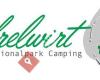 Nationalpark Camping Andrelwirt
16 km
Sehr gutes Preis Leistungsverhältnis. Wunderschöne Umgebung. Sehr gute Küche, mit aus...
Nationalpark Camping Andrelwirt
16 km
Sehr gutes Preis Leistungsverhältnis. Wunderschöne Umgebung. Sehr gute Küche, mit aus...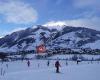 Haus Groder
20 km
Sehr schönes Appartment Zimmer 1 tolle Aussichten von beiden Balkonen. Betreiber sind...
Haus Groder
20 km
Sehr schönes Appartment Zimmer 1 tolle Aussichten von beiden Balkonen. Betreiber sind...hinzufügen eines Grossglockner High Alpine Road-stadtplans zu ihrer webseite;
Wir verwenden Cookies und andere Tracking-Technologien, um Ihr Surferlebnis auf unserer Website zu verbessern, Ihnen personalisierte Inhalte und gezielte Anzeigen anzuzeigen, unseren Website-Verkehr zu analysieren und zu verstehen, woher unsere Besucher kommen. Datenschutz-Bestimmungen